Sold · closed May 2026
17.08 acres per the 1976 recorded plat · about 1,700 ft of frontage on two state roads · a 2002 county septic permit on file for this exact parcel
📍 Dirgie Mine Rd at Lawson Chapel Church Rd, Roxboro, NC 27574 · open in Google Maps
Looking for something like it? See what is available now or tell us what you want.
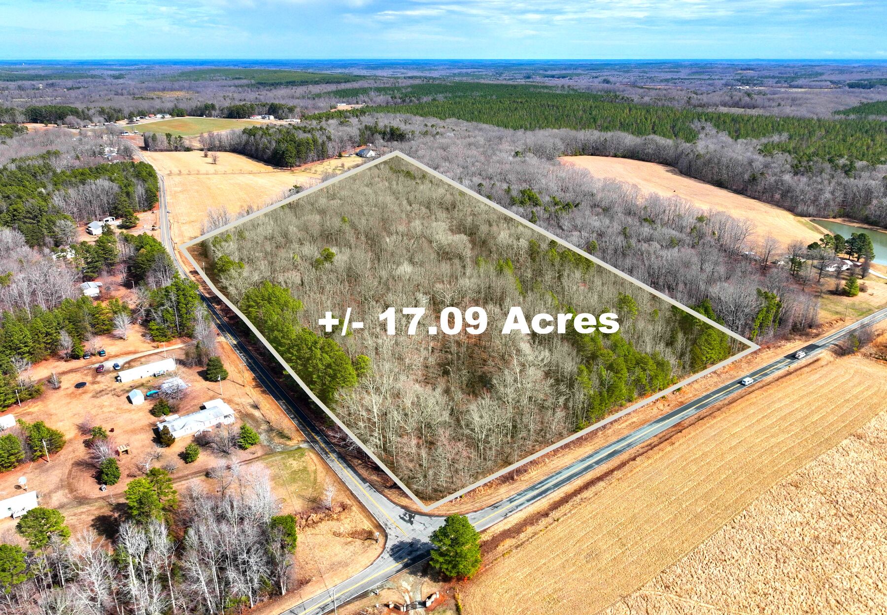
This was a 17-acre wooded corner in Person County that had been held by the same owner for about 24 years. From the road it is just timber. The question a buyer asks is what it can become, so that is the question we answered first.
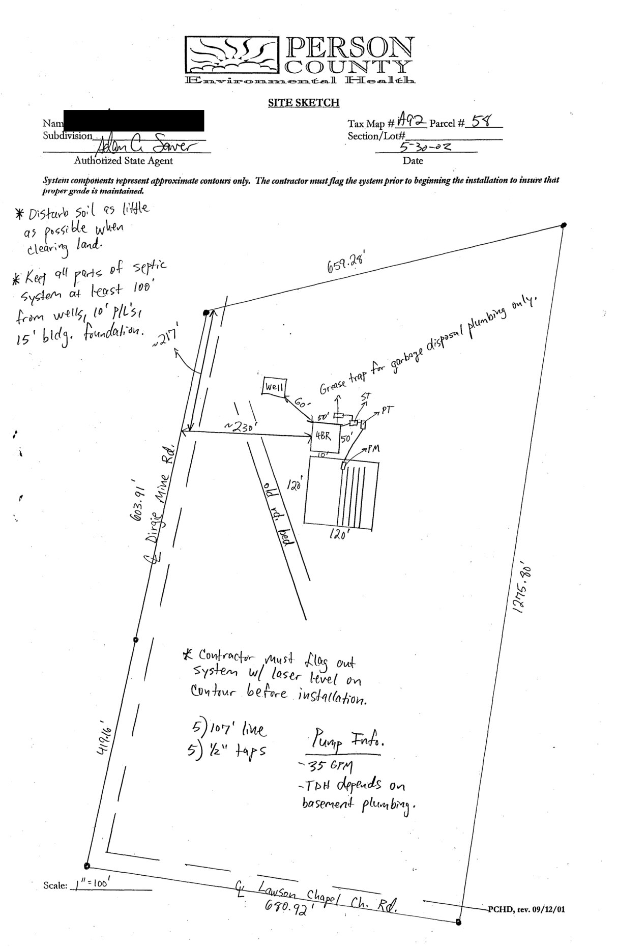
We called Person County Planning twice, in May 2025 and again in February 2026, and got the same answer both times: the tract could be split into up to five lots by minor subdivision, each at least an acre and 100 feet wide, and the long frontage on two state roads easily allows it. We pulled the 1976 recorded plat that created the parcel, and in the county's environmental health records we found a 2002 septic improvement permit for a four-bedroom house on this exact parcel, with the county's own site sketch.
Then we paid for a drone and ground inspection, because aerials hide things. It found an old shed, dumped tires and metal near one road, a few low spots that hold water, and two culverts already in place for a driveway off Dirgie Mine Rd. All of it went into the disclosure.
It sold whole, as one 17-acre tract, in May 2026. Everything below is the file as it stood at closing.
The diligence file as it stood at closing, including anything still open.
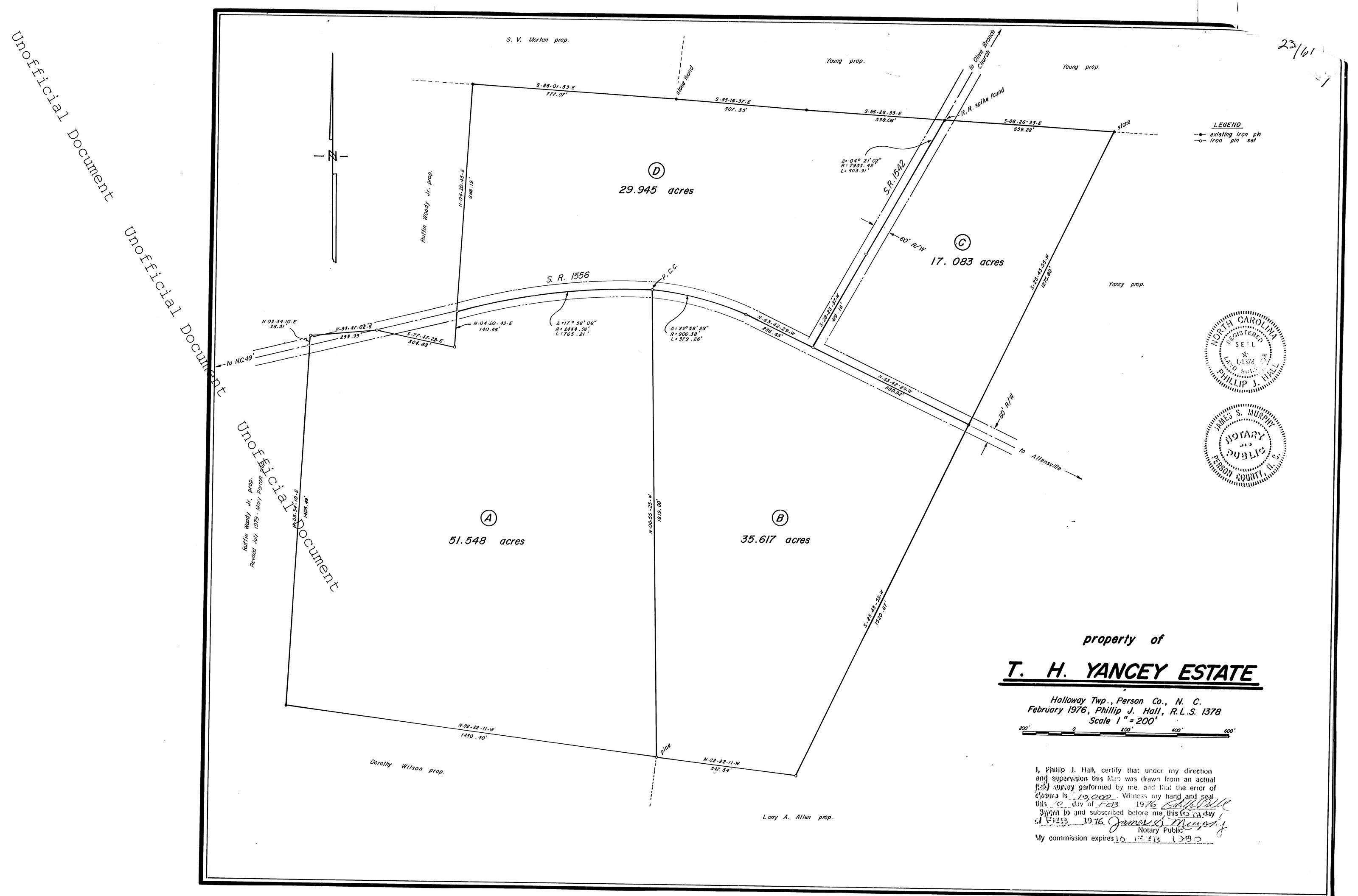
Parcel C of the T.H. Yancey Estate plat, surveyed by Phillip J. Hall, R.L.S. #1378, in February 1976 and recorded at Plat Book 23 Page 61, Person County. Parcel C is 17.083 acres. North line 659.28 ft; east line 1,275.80 ft.
Per the plat: 680.92 ft on Lawson Chapel Church Rd (SR 1556) and 419.16 ft plus a 603.91 ft curve on Dirgie Mine Rd (SR 1542), both with a 60 ft right of way. The 1976 deed calls both roads unpaved; both are paved today.
Person County Environmental Health Improvement Permit for Tax Map A92 Parcel 58: four-bedroom residence on a well, 480 gallons a day, pump to conventional, soil loading rate 0.30. A 1,000 gallon septic tank, 1,000 gallon pump tank, 1,605 sq ft of drainfield, 535 ft of line, trenches 18 in deep. Issued May 30, 2002 and valid five years, so it expired in 2007: a new site evaluation is needed to build. It still shows the county once approved soil for a system here, and where.
The county's sketch puts the house site about 230 ft in from Dirgie Mine Rd, a drainfield of about 120 by 120 ft below it, and the well about 60 ft off the house. It notes an old road bed across the tract and tells the contractor to disturb as little soil as possible when clearing.
Person County Planning, May 15, 2025 and again February 11, 2026: a minor subdivision is five lots or fewer; each lot at least 1 acre and 100 ft wide; a lot without road frontage needs a 50 ft access easement. Six or more lots is a major concept plan through the planning board and commissioners. A perc check before splitting is wise but not required. We never split it; it sold whole.
Drone and ground inspection, February 20, 2026. Rolling ground falling generally north-west to south-east, mostly hardwood with light to moderate undergrowth, and several low spots holding water. An old dirt driveway, heavily overgrown, and two culverts on Dirgie Mine Rd that would carry a driveway. A raised wood and steel shed, not fit to live in. Tires, steel and old machinery dumped near the western road, and rock piles at the north end that may cover old refuse.
Power runs along the road frontage (photographed). No public water or sewer: the 2002 permit assumes a well and septic. No gas.
Insured title; the deeds carry only "restrictions of record, if any" as an exception. No HOA, and the tract fronts both roads directly, so access does not run over anyone else's land.
Buyers
Tell me what you are looking for. Most of what I buy never reaches a page like this; it goes to whoever already told me what they wanted.
Odd lots, divided parcels, land with a question hanging over it: that is most of what we buy. We do the survey, the soil work and the calls to the city and county ourselves, and we put what we find in writing.
35 closings across 24 counties in five states. Noble Land Partners® is BBB accredited with an A+ rating, 18 customer reviews averaging 5 stars, and no complaints closed in the last three years.
 Noble Land Partners