Sold · closed March 2026
10 acres by recorded plat · about 213 ft on paved Jones Road · a long strip about 215 ft wide and 2,100 ft deep
📍 Jones Rd, Eatonton, GA 31024 · open in Google Maps
Looking for something like it? See what is available now or tell us what you want.
A long, narrow ten-acre strip of woods on a quiet paved road in the far south-west of Putnam County. The owner had bought it years earlier as a favour to someone who was losing it for unpaid taxes, and had seen it once.
The county record showed several quitclaim deeds in the chain, which is how a missing heir or an unreleased interest hides. So before anything else we asked about heirs and missing parties, and the closing attorney ran a full title search. It took about three weeks and came back clean.
Our buyer wanted to be sure no neighbour had a recorded road across the land, so we made the sale conditional on it and asked the attorney directly. The answer: none appeared in the title search.
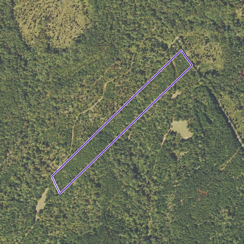
The shape, about 215 ft wide and 2,100 ft deep, falling toward the back, made it a hunting and recreation tract rather than a place to split. It sold to a local buyer in March 2026, closing the same day we did.
The diligence file as it stood at closing, including anything still open.
Tract 2, 10.0 acres, Land Lots 211, 212, 227 and 228, 10th Land District, per a plat by Edwin L. Thompson, RLS #1759, Freeman Land Surveyor, December 12, 2003, recorded Cabinet D, Book 28, Slide 62, Page 208, Putnam County.
Full title search by the closing attorney, March 2026: clean. The deed conveys subject only to easements, restrictions and rights of way of record.
The buyer's contract could be cancelled if any recorded access easement for a neighbour turned up. Asked directly on March 12, 2026, the attorney answered: none appeared in the title search.
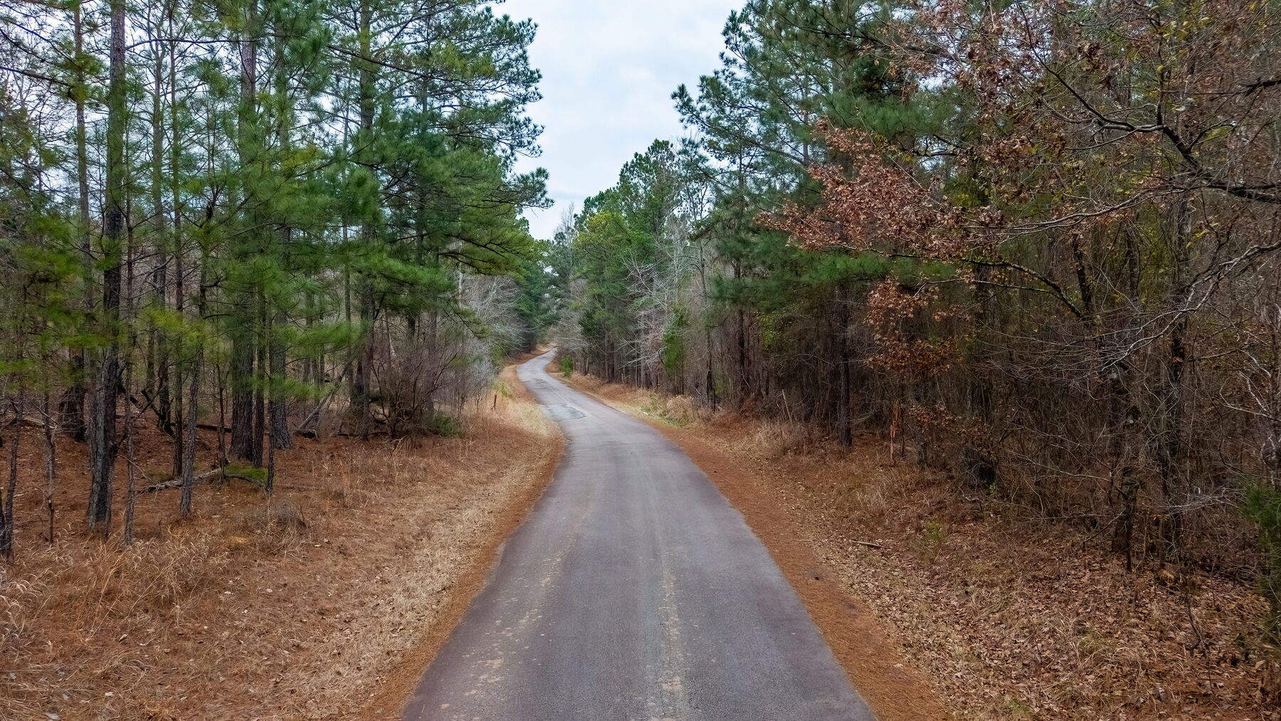
About 213 ft on Jones Road, a narrow paved county road. The parcel runs roughly 215 ft wide by 2,100 ft deep, north-east to south-west.
USGS elevation 465 to 533 ft, average slope about 13.5%. USDA soil survey: Davidson clay loam and loam, well drained, with about 46% of the strip on 10 to 25% slopes, which the survey flags as a steep-slope limit for septic. Map data only: no perc test was done.
Agricultural zoning. No mapped flood zone and no mapped wetlands. No structures, no HOA.
Putnam County takes driveway and 911 address applications online; we found both but did not file them. Power is Tri-County EMC.
Buyers
Tell me what you are looking for. Most of what I buy never reaches a page like this; it goes to whoever already told me what they wanted.
Odd lots, divided parcels, land with a question hanging over it: that is most of what we buy. We do the survey, the soil work and the calls to the city and county ourselves, and we put what we find in writing.
35 closings across 24 counties in five states. Noble Land Partners® is BBB accredited with an A+ rating, 18 customer reviews averaging 5 stars, and no complaints closed in the last three years.
 Noble Land Partners