Sold · closed October 8, 2026
Two recorded ±1.93-acre tracts inside the city limits · City water and sewer at the frontage · Double-wides permitted
Two buyers walked away from this one before it closed. We kept the diligence going, published every answer the city and county gave us, and sold it. The file we built is below, as it stood at closing.
📍 Forrest Clary Dr, Thomson, GA 30824 · open in Google Maps
Looking for something like it? See what is available now or tell us what you want.
We put a single 3.73-acre parcel on Forrest Clary Drive under contract in the summer of 2026. On paper it was a hard sell: NRCS maps about 70% of it as hydric flood-plain soil, there are drainage ditches across it, and the building area on one side sits well back from the road.
So we did the work before asking anyone to believe it. We had it surveyed and divided into two recorded lots, approved by the county planning commission on August 18, 2026. We had the county's Community Development Director walk it, and he ruled in writing that the ditches are stormwater, not state waters, with no buffer. We paid a certified soil classifier for eight borings across both lots and published the result, good and bad, as we had said we would.
Then the city raised its tap fees partway through the deal. A developer who had already signed walked over it, and he was right to: the new fees were real. A second buyer passed over the cost of running utilities to the rear lot. We did not argue with either of them. We got the new fees from the head of water and sewer in writing, put the rear-lot utility cost on the page instead of leaving it for a buyer to find, and priced each lot for what it actually is.
The contract was assigned and closed on October 8, 2026. Everything below is the diligence file as it stood at closing. It stays up because it is the clearest picture of how we work a tract.
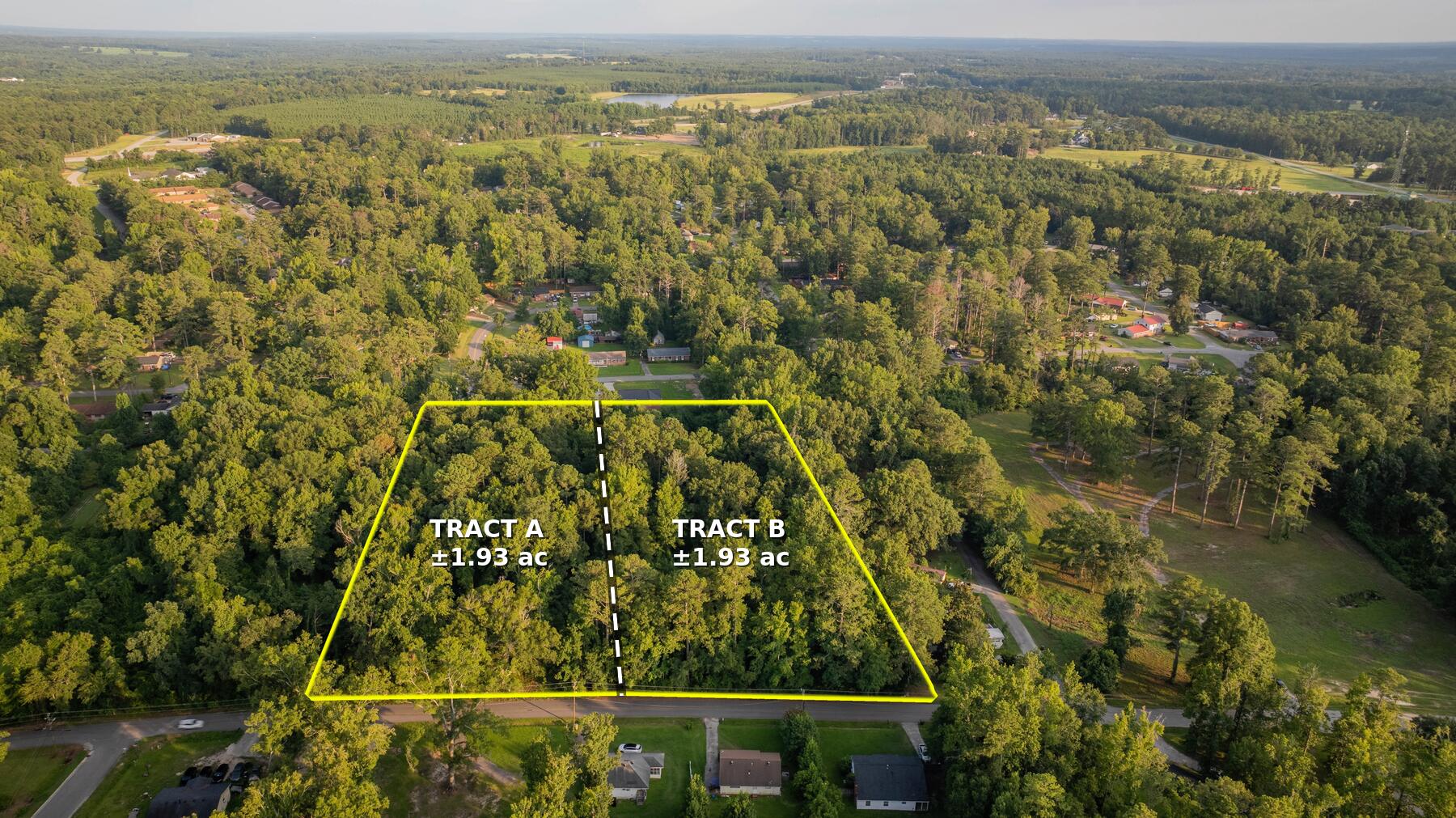
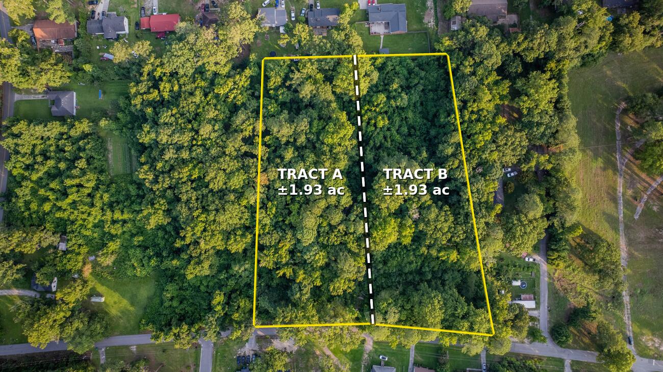
The parent parcel was surveyed on July 31, 2026 and divided into two tracts of ±1.93 acres each. The plat was approved by the McDuffie County Planning Commission and recorded on August 18, 2026. Both are conforming lots of record inside the City of Thomson, and both front Forrest Clary Drive.
City water and city sewer run at the frontage: no well, no septic, no perc test. The water tap is $4,400 and the sewer tap $8,320, which is $12,720 a lot, confirmed in writing by the head of water and sewer under the schedule in force today. Manufactured homes are permitted, double-wides only; the city does not allow single-wides.
On August 21, 2026 the county's Community Development Director walked the property and issued a written determination that the ditches are stormwater conveyances, not state waters: no buffer, no special consideration. That frees the full depth between Forrest Clary and the drainage for a home site.
We said we would publish the soil result either way, and it is back. Eight borings across both tracts put the front band, where a home sits inside the 25 ft setback, in Altavista soil: seasonal high water table at 20 inches, no flooding, rated by the classifier as usable for construction. The rear of both tracts is Alcovy, also rated usable for construction. One band behind the frontage on Tract B is Cartecay, at a 12 inch water table with rare flooding, which he rates buildable only if drainage is carried away from the foundation. The full read, and what the survey does not cover, is below.
Every line below came from calls with the head of water and sewer for Thomson-McDuffie, on August 12 and again on September 10, 2026, and for the tap fees from his email confirming the current schedule in writing. None of it is a guess by us, and where he did not know, we say he did not know. The tap fees on this page are the figures in force today, confirmed by the city in writing.
The gravity sewer main runs the full frontage of the parcel, confirmed on the city's own GIS. The two manholes near the property are both sanitary. Neither is storm.
Tony Daniel · Head of Water & Sewer, Thomson-McDuffie · August 12, 2026$4,400 for a ¾" meter under the schedule in force today, confirmed by the city on September 10 and since in writing. The 1" and 2" prices are not stated on the current schedule. The main sits on the opposite side of Forrest Clary. The city performs the bore and sets the meter on this side, inside the tap fee. Multiple taps are allowed with no capacity objection, which is what makes two homes possible here.
$8,320 each. The city sizes the sewer tap off the water meter, and $8,320 is the figure that goes with a ¾" water tap. Confirmed in writing by email from the head of water and sewer, replacing the approximate figure he first gave from memory on September 10. City policy is unchanged: if a tap is purchased and a pre-existing lateral is later located, the city refunds the payment.
The city's recommendation is that a grinder pump is not needed here: a manufactured home sits elevated on its piers, which raises the outlet relative to the main. We are leaving this marked open only because the invert elevation is not yet in the city's GIS, so nothing has been physically shot. If one does turn out to be needed, a grinder is permitted to the connection point. A cost variable with a known ceiling, not a question of whether the property can be served.
The city runs both connections to the right-of-way. From the connection point to the structure is the owner's cost, water and sewer both. On Tract B that run is short. On Tract A it is roughly 500 feet, and it is priced as its own line in the underwriting above.
Both figures come from the head of water and sewer in writing rather than from a verbal quote: $4,400 water and $8,320 sewer, $12,720 a lot for a ¾" meter. We asked him directly on September 10 whether he expected the schedule to change, and the answer was no. These were the fees in force in September 2026.
These lots sit inside the City of Thomson, so the city’s R-1 standards govern, not the county’s. Thomson and McDuffie County run a single consolidated Community Development office, so the same desk answers for both and the parcel has to be pulled up to know which set of numbers applies. It was, on a return call on July 21, 2026, with the parcel number on his screen. The county’s Community Development Director independently confirmed the same thing on August 20, looking at the parcel: R-1, city.
Twenty five front, twenty five rear, ten from the side.
Leslie Walker · Planning & Zoning, Thomson-McDuffie Community Development · July 21, 2026, put in writing September 9, 202625 ft front, 10 ft each side, 25 ft rear. The front setback runs from the property line at the right of way, not from the centerline of the road; the administrator caught and corrected that datum himself mid-call. An earlier July call produced a different front number, taken before the parcel had been established as sitting inside the city. We asked him to put the numbers in writing, and on September 9, 2026 he did, with a link to the governing ordinance section: Thomson Code of Ordinances § 22-58. Same official, same three figures, same right of way datum. Nothing moved between the call and the email.
15,000 sq ft of area and 100 ft of road frontage per lot, per the zoning administrator. The building official quoted a different figure on a separate call, half an acre where city water and sewer are in use. Which one governs does not matter here: each recorded tract is ±1.93 acres, about 84,000 sq ft, with roughly 140 ft of frontage, and clears either standard several times over. Which is why the plat was approved as drawn. The city confirmed the parent parcel could legally have carried three lots. We recorded two on purpose, so each buyer gets depth instead of a strip.
Stick built, modular or manufactured. Manufactured must be a double-wide; the city does not permit single-wides. Minimum 1,100 sq ft. Confirmed twice and independently, by the zoning administrator in July and the county building official in August.
Take the roughly 140 ft of frontage, subtract 10 ft of side setback on each side, and you have about 120 ft of buildable width. Depth runs from the 25 ft front setback back to the drainage, which sits roughly 100 to 127 ft off the road, giving a band on the order of 75 to 100 ft deep. A typical double-wide is 28 to 32 ft deep by 60 to 76 ft wide, so it fits, and it fits in front of the drainage. We are showing the arithmetic rather than a conclusion. The inputs are the recorded plat and the city’s own standards, but nobody has staked a building envelope on the ground. The completed soil survey puts this band in Altavista on both tracts and rates it usable for construction, which is the best-rated ground it found on either tract.
A shared driveway is not permitted; each tract needs its own. Only one has to be built, though: the county building official confirmed the existing driveway can serve one of the two lots, and the culvert under it was measured at 20 ft wide, wide enough to carry the crossing with a land bridge. One sequencing point worth knowing before you plan a build: the driveway permit has to be issued and passed before the building permit will be. Whether the surface can be gravel is a road department question, not a zoning one, and the zoning office declined to answer for them rather than guess.
One point of precision, stated plainly: the setback figures are now in writing, in an email from the zoning administrator dated September 9, 2026, but an email is not a formal zoning verification letter. Two officials have independently confirmed this parcel is city R-1, each with it pulled up in front of them. The setback numbers come from one of them, first by phone on July 21 and now on paper, and they did not change between the two.
This is the diligence table as it stood when the contract was assigned, including the items that were still open and the ones we left for the buyer to verify.
I went over to the property this morning and walked around. There are a few items on the checklist that would be for the ditch being a stream, but there were more that were missing. I am deeming the ditches on this property to be stormwater conveyances, requiring no buffer or special consideration. I would once again strongly advise against changing or removing them.
Brett Parsons, PE · Community Development Director, Thomson-McDuffie County · August 21, 2026Surveyed July 31, 2026 by John A. McGill, Georgia RLS #1753, job 2026-2730. Approved by the McDuffie County Planning Commission on August 18, 2026 and recorded the same day at Bk E2026 Pg0069, McDuffie County Superior Court. Both tracts are ±1.93 acres and are conforming lots of record. Note that the plat carries no topography, no creek location and no flood zone.
Completed September 2026 by Brian Lucas, Georgia certified soil classifier #189, Lucas Soil Evaluation. Eight borings, read from redoximorphic features rather than today's free water level, since late summer is the annual low. Three series were found:
| Soil | Where it sits | Water table | Flooding | Classifier’s rating |
|---|---|---|---|---|
| AltavistaBorings B1, B3, B4, B5 | Front band of both tracts, along Forrest Clary | 20 in | None | Can be utilized for construction |
| AlcovyBorings B6, B7, B8 | Rear block of both tracts | 28 inrefusal at 32 in | None | Can be utilized for construction |
| CartecayBoring B2 | One band behind the frontage, Tract B side | 12 in | Rare | Possible, but only with drainage diverted away from the foundation area |
The part that decides a home site: the front band of both tracts is Altavista, at a 20 inch water table with no flooding. That is the same band the setback arithmetic above puts a house in, and it is the best-rated ground the survey found on either tract.
Three limits, stated plainly. First, the survey covers a front band and a rear block on each tract; the middle of each tract was not inventoried, and the NRCS mapping is still all anyone has there. Second, every suitability code on that survey is a septic rating, and these lots are on city sewer, so those codes do not govern here: what carries over is the water table, the flooding and the construction note. Third, it carries no bearing capacity, and the classifier notes that cutting or grading in the inventory area voids the report.
How it compares to the free data. NRCS maps the parent parcel as roughly 63% Wehadkee, 7% Worsham and 30% Altavista. The borings found Altavista where NRCS puts it, along the road, and in the areas inventoried behind it they found Alcovy and Cartecay rather than Wehadkee, with flooding rated none or rare instead of frequent. NRCS is a desktop map at a coarser scale and the borings are the site-specific read, so for these tracts the borings govern where the two differ. Where the survey did not reach, NRCS is still the only picture.
On footings specifically: the county's position is that a high water table does not preclude footings: it is a concrete mix-design question, and footings address the soft-ground problem that piers alone would face. That is the Community Development Director's read, and he is a licensed PE who poured bridge concrete underwater for GDOT. The survey is available on request.
The Community Development Director walked the property on August 21, 2026 and issued a written determination: the ditches are stormwater conveyances, not state waters, requiring no buffer or special consideration. That removes the 25-foot undisturbed buffer question entirely and frees the full depth between Forrest Clary and the drainage. The ditches must be left in place: the county advised strongly against altering or removing them, and nothing in the plan requires it.
Manufactured homes are permitted here: double-wides only. The city does not allow single-wides. Zoning is 1R. Buyers should still confirm setbacks and any appearance standards, such as foundation type or minimum roof pitch, directly with the county.
No HOA appears on the county record and none is known to us. One third-party data aggregator flags this parcel as sitting inside an HOA, which we believe is a mapping artifact rather than a recorded covenant, but we are confirming against the recorded documents and will state the answer either way. Raised here because a buyer running the same data will see the same flag.
Confirmed with the county on August 20, 2026. Residential land disturbance is folded into the building permit: a standalone land disturbance permit is only triggered by commercial work or by disturbing more than an acre, neither of which applies to a single home site. And no soil report is required to permit the foundation; the manufacturer's installation template is submitted with the building permit and reviewed by the county.
Both tracts are wooded. Clearing, pad prep and any fill required to reach a competent bearing surface are real line items. Bid locally.
The recorded plat states that flood zone information is not shown on the survey. No mapped flood zone appears on the parcel in third-party mapping, but we have not obtained a FEMA determination. Verify independently.
The current bill on the parent parcel is $543.33 a year. Millage is 30.19 for Thomson District 02 and the record shows no homestead exemption. Georgia assesses at 40% of fair market value, so a sale would likely trigger reassessment. A separate fire fee applies, and the tracts will be billed separately once the split is reflected on the tax roll.
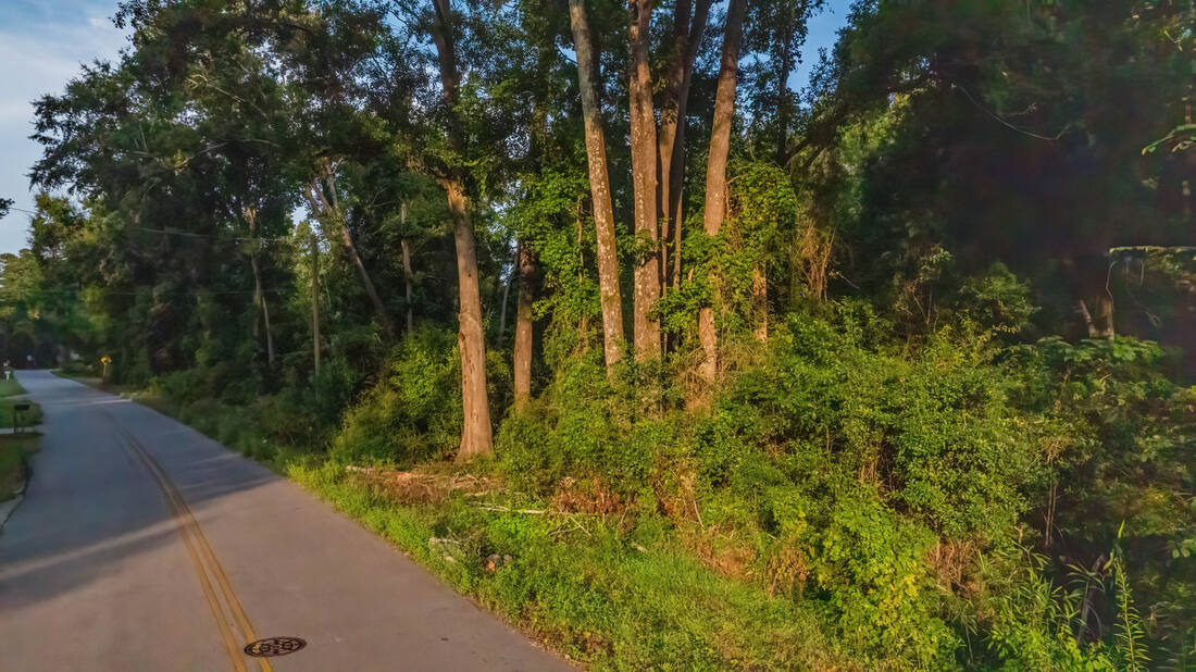
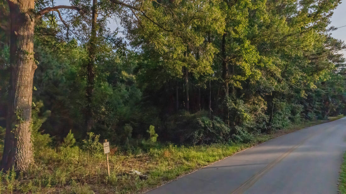
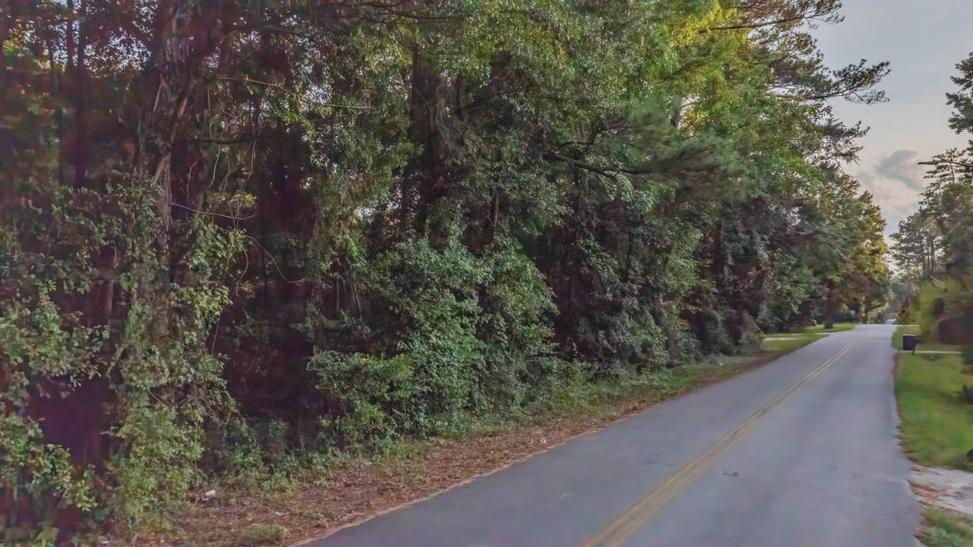
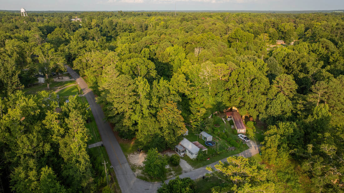
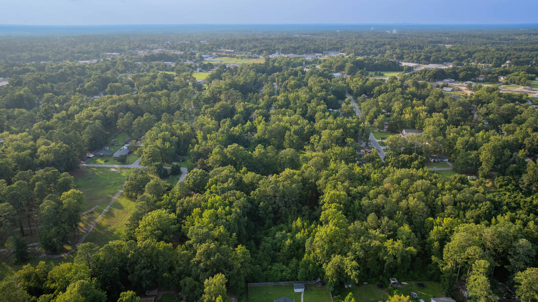
Aerials flown July 2026, oriented as you would see the property standing on Forrest Clary. The yellow outline is the parcel boundary and the dashed line is the recorded division. Both are illustrative overlays, not a substitute for the recorded plat at Bk E2026 Pg0069.
Buyers
Tell me what you are looking for. Most of what I buy never reaches a page like this; it goes to whoever already told me what they wanted.
Odd lots, divided parcels, land with a question hanging over it: that is most of what we buy. We do the survey, the soil work and the calls to the city and county ourselves, and we put what we find in writing.
35 closings across 24 counties in five states. Noble Land Partners® is BBB accredited with an A+ rating, 18 customer reviews averaging 5 stars, and no complaints closed in the last three years.
 Noble Land Partners