S Price Road · Crawford County, Arkansas
22.37 acres of white and red oak in the Boston Mountains, half an hour south of Fayetteville. Electric is already on it. The listing says the topography allows for multiple build sites, and it does: there is a nine-acre bench across the middle and a high shelf near the top corner. The access road is steep in three places, and that is on this page too.
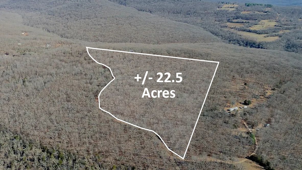
Boundary shown is approximate. The overlay reads 22.5 acres; the recorded survey says 22.37, and that is the figure used everywhere on this page. The survey itself is here (PDF).
📍 S Price Road, Crawford County, AR · open in Google Maps · Parcel 001-17902-000
Noble Land Partners is a joint venture partner on this deal. We sourced it, we commissioned the survey, and the terrain work below is ours. Title is held by our venture partner Off Grid Acres LLC, and the tract is listed by Chris Shadrick of Midwest Land Group, ArkansasOne MLS 1335884. Everything on this tract goes through Chris: 479-530-2470. Showings, questions and written offers all start with him. The research on this page is ours and he can get you any of it, so ask him rather than hunting for it yourself.
Nothing here is a permit or an approval. Where we measured something, we name the instrument. Where nobody has checked yet, the page says so instead of leaving a gap for you to find later.
A 40-acre parent, the NW 1/4 SW 1/4 of Section 1, T-12-N, R-30-W, was split along the centreline of Price Road, which runs diagonally across the forty from the west line just above the south-west corner to the east line just below the north-east corner. The north-western 17.29 acres sold in May as Tract 1. This is Tract 2, the south-eastern 22.37: the road is its whole north and north-west boundary, and it takes the forty’s south line end to end, 1,332.22 ft, and all but the top 6.74 ft of its east line, 1,294.27 ft.
Crawford County’s GIS carries the new parcel lines, so the boundary is on the county map. The parcel data behind most land sites still carries the undivided forty, so acreage, slope and elevation figures pulled from those sources describe the wrong shape. We rebuilt this tract from the metes and bounds on the survey: twenty-two courses, fifteen of them curves following the road. The traverse closes on its point of beginning within 0.01 ft over 4,734 ft of perimeter, and computes 22.3718 acres against the 22.37 the surveyor stated. Everything below is measured inside that boundary and no other.
The shape of the ground
Thirteen and nine tenths of the 22.37 acres sit under 15% grade. Scattered acreage is not a building site, so the number that matters is how much of it is in one piece.
Nine and seven tenths acres in one connected piece, lying across the middle of the tract at 1,530 to 1,589 ft. That is room for a house, a drive, a septic field and its reserve area, and a yard, without fighting the hill for any of it.
A separate 1.2 acres under 15% sits at 1,603 to 1,620 ft against the east line, just below the tract's high point. Small, and the highest ground on the property. Two genuinely different places to build, not one described twice.
Price Road is the boundary itself rather than an easement across a neighbour. No point on the tract is more than 874 feet from it, and just under nine acres lie within 200 feet. On mountain ground the driveway is often the biggest line item, and here it does not have to be.
USGS 3DEP elevation, the 10-metre national dataset, sampled inside the surveyed boundary, with grades computed over roughly 100-foot windows. One-metre lidar does not cover Crawford County. It is right about the shape of the ground and approximate about any single spot on it.
The access
The feedback the listing agent gets most is that the road is not that nice. Rather than argue with it, we measured it. Price Road runs 1,992 feet along this tract, a little under four tenths of a mile, and climbs 137 feet from 1,461 ft at the west end to 1,598 ft at the east.
What that means in plain terms. This is a dirt mountain road with three real pitches on it. Sixteen percent is steep: a low-clearance car will manage it dry and will not enjoy it wet. If you are picturing a paved approach to a suburban house, this is not that, and you should know before you drive four hours to look at it.
We said we would publish the answer either way, so here it is. Crawford County Road Department, September 8, 2026: Price Road is not county maintained, and neither is Carter Lane Road, the road that connects it to US 71. Upkeep is the property owners' responsibility.
The department was careful about one distinction and it deserves repeating. Asked directly whether that made it a private road, they said they could not say that, only that it is privately maintained. Not county maintained is a statement about who grades it, not about who may drive it. Their own field test is the sign: a red road sign means not county maintained, blue and green mean the county keeps it up.
What the drive actually is. From US 71 it is about 2.6 miles of unpaved road to this frontage, roughly 1.6 miles on Carter Lane and about a mile on Price Road, which dead ends past the tract. Every foot of that is kept up by the owners along it rather than by the county. No recorded road maintenance agreement surfaced in the title work when the current owner acquired the parent tract, and we have not found one since. If your own title search turns one up, we will publish it here. If bank financing is your route, raise the access with your lender early, because some will want a maintenance agreement on a road like this. Owner financing is available on this tract and does not run into that question at all.
Two limits on the measurement above, stated plainly. The grade profile comes from a bare-earth elevation model, so it is the shape of the climb rather than a survey of the running surface. And the profile itself covers only the 1,992 ft bordering this tract; the 2.6-mile figure for the whole approach is measured off road centreline data rather than driven with a wheel, so treat it as close rather than exact.
What runs across it
Both are ordinary for rural ground, both came with the land and both will go with it again. They are worth reading before you pick a build site, because one of them carries a building restriction.
1. A neighbour can drive across the south-west corner. An easement deed dated April 3, 1985 and filed for record on April 22, 1985 at Book Misc 53, Page 181 grants the owner of the adjoining property to the south the right of ingress and egress only, over a roadway approximately twelve feet wide at the south-west corner of the forty, connecting that property to the existing road winding through it. The grantee named in the deed is Carl E. Patton. An easement of record runs with the land, so the right belongs to whoever owns that property today, and we have not identified who that is.
The words are narrow ones and they are worth taking literally. Ingress and egress only is a right to come and go. It is not a right to park, to build, to run utilities, or to widen the roadway, and it carries no interest in the rest of the tract.
The easement is not drawn on the plat, and that was a deliberate call. Satterfield asked whether we wanted it drawn in, to make it less ambiguous, and we said no. The easement is already in the land record and the words of the 1985 deed are what govern it. Drawing it would have meant fixing a line on the ground and making it permanent, on a right of way that has never been staked and that belongs to somebody else, and a filed survey becomes public record. We did not think that was ours to settle. So the plat carries a note instead, saying the recorded easement for the south adjoining owner is not shown “as per clients instructions”. What the plat does draw in that corner is a ten foot gravel drive running south off Price Road and out across the south line, 172.22 feet east of the south-west corner. That drive is the obvious candidate for the roadway the 1985 deed describes, but the survey does not say so and the easement has never been staked, so its exact line and width on the ground are not established. If it bears on your plan, a surveyor can locate it.
2. The power line has a strip, and that is the one with the restriction. A second easement, signed May 4, 1989 and recorded at Book 89-17, Page 484, gives the electric utility a strip ten feet wide, five feet either side of the overhead line. It begins at the north-east corner of the forty, runs about 110 feet west, then south-westerly following the existing dirt road, and ends on the south line about 149 feet east of the south-west corner. The survey bears that route out on the ground. Satterfield located the poles physically and labelled the line as overhead electric: they run the length of Price Road along the frontage, then turn south with the gravel drive, and the last one stands 25.94 feet short of the south line. The deed puts the end point about 149 feet east of the south-west corner while the plat puts the drive crossing at 172.22 feet, roughly 23 feet apart, which is what you get from a 1989 description that says “approximately” three times and was never staked. Price Road is this tract’s own north and north-west boundary, so along that stretch the strip runs with the edge of the tract rather than through the middle of it.
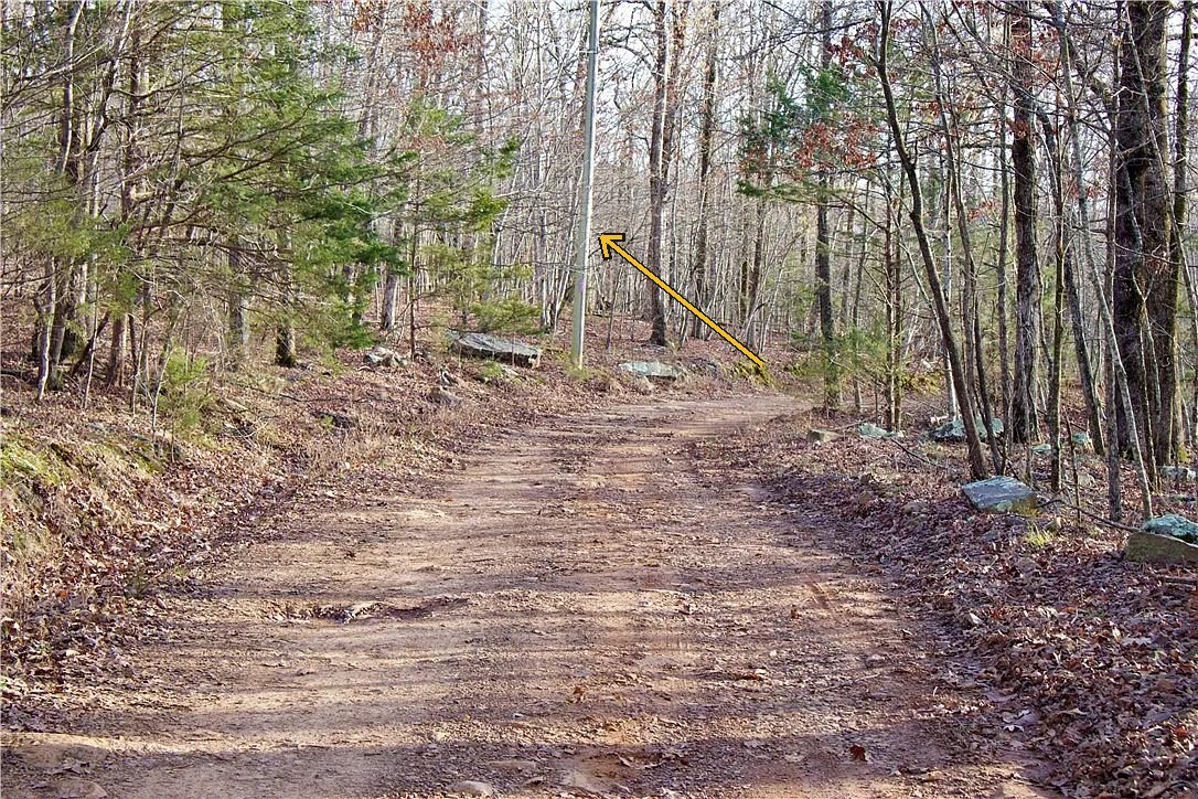
Inside that strip the deed allows no building or other structure, and no excavation or change of grade, without the utility’s written consent. That is the sentence to hand your builder, because it is the one that can move a house or a driveway cut. It is also the reason there is electric on this tract at all, so the same strip is both the cost and the benefit.
Neither easement makes this tract hard to build on. The nine acre bench and the high shelf both sit well east of the south-west corner, and the gravel drive crosses the south line about 172 feet from it. What the two of them mean in practice is that the south-west corner is shared ground, and that anything going into the ground along the road or along that drive wants the utility’s sign off first.
The water
Arkansas keeps a construction report for every well a licensed driller puts in the ground. For this part of the state the numbers were never typed up, only scanned, so we pulled the permits for this township and read them off the forms. Sixty eight of them carried usable numbers, and three are in this tract’s own section.
The answer they give is that wells here are shallow but slow. Plan on drilling 200 to 220 feet and on hitting water around 30 feet down. What you will not get is volume. The median well in this township makes 0.8 gallons a minute, and the three in this section came in between 0.25 and 0.58.
That is still a house, but only built the way this mountain is already built. A well making half a gallon a minute yields 720 gallons a day and a family of four uses two to four hundred. The constraint is not the daily total, it is how fast you can draw it, and the answer here is a storage tank and a low yield pump rather than a deeper hole. Put that in the budget beside the drilling, not after it.
Two of the three in this section share one set of coordinates and were drilled five weeks apart in 2001, which reads as a first hole and a second attempt. They sit four tenths of a mile away at 1,543 feet, within ten feet of this tract’s own elevation, so nothing needs correcting for terrain. They are the closest thing to a test hole this property will ever have without drilling one.
| Where | Completed | Depth | Water level | Yield |
|---|---|---|---|---|
| Section 1, 0.40 mi | Dec 2001 | 220 ft | 32 ft | 0.58 gpm |
| Section 1, 0.40 mi | Nov 2001 | 220 ft | 87 ft | 0.25 gpm |
| Section 1 | Dec 1995 | 200 ft | 40 ft | 0.25 gpm |
| Section 12, 0.81 mi | May 1994 | 200 ft | 40 ft | 2.50 gpm |
| Section 12 | Jul 1974 | 205 ft | 40 ft | 5.00 gpm |
| Section 12 | Jul 1974 | 400 ft | 40 ft | 5.00 gpm |
| Section 11, 1.33 mi | Jul 1997 | 160 ft | 20 ft | 0.50 gpm |
| Section 3, about 2 mi | Sep 1977 | 331 ft | 190 ft | 10.0 gpm |
| Section 3, about 2 mi | Jul 1973 | 148 ft | none | dry hole |
| Section 2, about 2 mi | Mar 1976 | 122 ft | 20 ft | 0.25 gpm |
| Section 6, about 3 mi | Oct 2003 | 142 ft | 38 ft | 0.25 gpm |
Arkansas Geological Survey water well construction reports, read from the filed forms. Yield on these forms is recorded in gallons per hour and is converted here.
The best well within a couple of miles makes 10 gallons a minute, and it took 331 feet to get there with water standing 190 feet down. About two miles away someone drilled 148 feet and found nothing at all. A second hole in this section in 2001 came in at a quarter gallon after the first one did the same.
That spread is the truth about a fractured sandstone and shale aquifer. Yield depends on whether the hole happens to cut a fracture, and no two neighbours are promised the same result. Anyone planning to build here should carry the cost of a second hole as a real possibility rather than a remote one.
The salt people run into around here is not sea salt. It is sodium and bicarbonate, and the USGS reports it in this aquifer at 500 to 2,000 feet below the surface. The deepest well ever drilled in this township is 400 feet, so nothing here has ever gone deep enough to reach it.
Chester sits at roughly 1,030 feet. This tract sits at 1,553. A 300 foot hole at Chester bottoms out around 730 feet of elevation; the same hole here bottoms out around 1,250, some five hundred feet higher in the fresh water. Of the six wells around this tract that have ever been tested, chloride runs 2 to 20 milligrams per litre against a 250 standard, and the single mineralised one sits 400 feet lower down the mountain than we do.
Here is the limit of that. Those six samples were taken between 1949 and 1960 and not one of them is in this township. No well here has ever been sampled for chemistry, and none has been drilled deep enough to test the saline zone. This is enough to explain why Chester is a different situation. It is not a promise about what comes out of a hole on this tract, and nobody should read it as one.
One thing the tested wells do show: two of the three on high ground carry iron at 15 to 31 milligrams per litre against a 0.3 standard. If iron is the local trade for staying out of the sodium, that is an ordinary filter, and it belongs in the plan rather than in a surprise.
Not on the state’s map. This tract falls outside every mapped public water service area in Arkansas. The two nearest boundaries are Washington Water Authority, three quarters of a mile north, and Winslow Waterworks, about the same distance to the south east. The tract sits in the gap between them. Chester Water Works is four miles away and serves 84 connections.
A service area boundary is a franchise territory, not a pipe, so being three quarters of a mile from one says nothing about where the nearest main actually runs. The more telling fact is in the well record itself: somebody drilled 220 feet in this section in 2001 for a quarter gallon a minute, and nobody pays for that with a tap available.
Plan on a well. This tract is two and a half miles down a dead end at 1,553 feet, it sits outside every mapped service area, and the people who owned ground in this section in 1995 and again in 2001 paid to drill rather than connect. We have not rung either district to have it said out loud, so we are not going to tell you it is impossible. If you want to chase it, they are Washington Water Authority on 479-267-2111 and Winslow Waterworks on 479-634-3901. Ask whether they have a main on Price Road and what a connection would run.
The going rate a buyer was recently quoted nearby was $12,000 for 300 feet, which works out to about $40 a foot all in. The 200 to 220 feet this section actually needs prices at roughly $8,000 to $8,800, before the pump, the pressure tank, storage and any filtration.
Nobody has been quoted for this tract yet, and that is the next thing on this page. It is worth knowing that no licensed water well contractor is based in Crawford County, and that none of the outfits that drilled the wells in this record still holds a licence. The nearest working drillers are Ozark Water Well and Pump in Fayetteville, 469-734-6562, and Moore Brothers in Prairie Grove, 479-824-2272. When you call them, ask for the overage rate in writing and for what happens past 250 feet. That line matters more than the headline price.
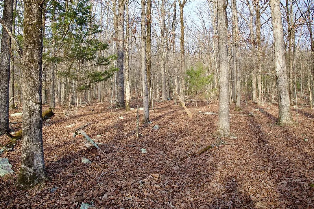
Photographed leaf-off. Nothing on this page is a rendering.
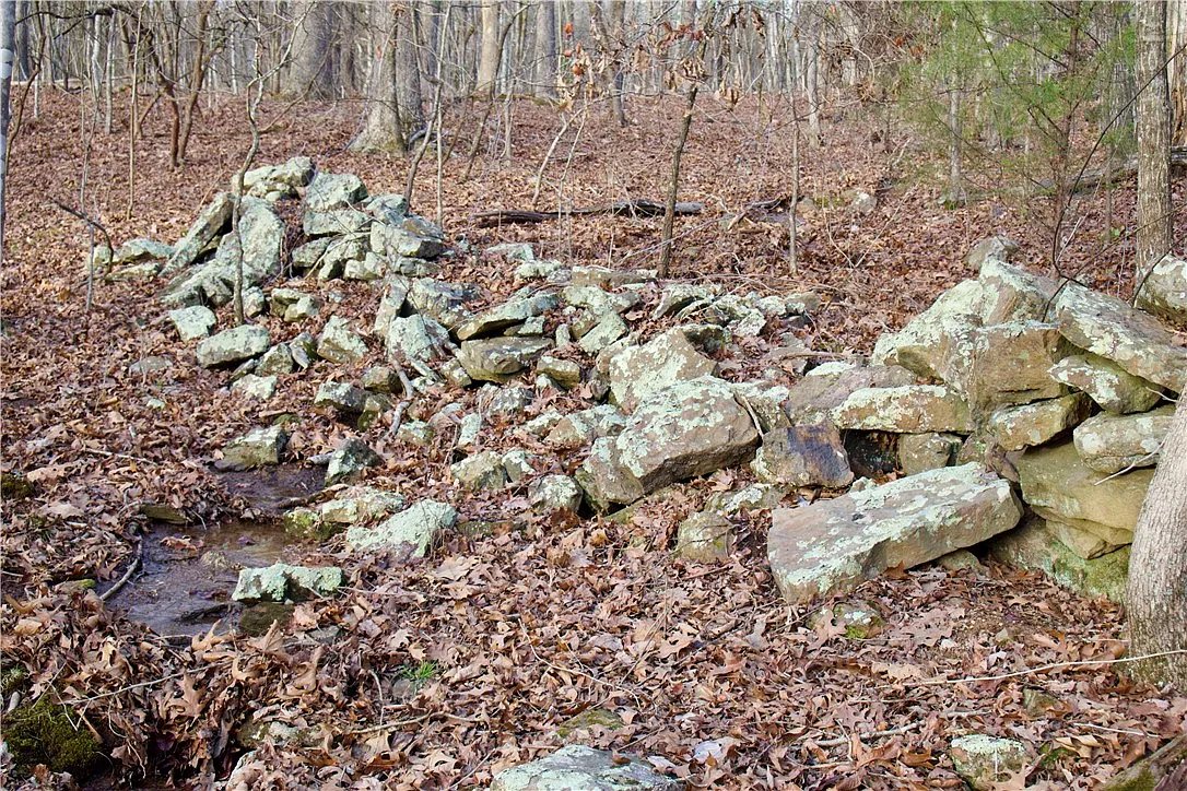
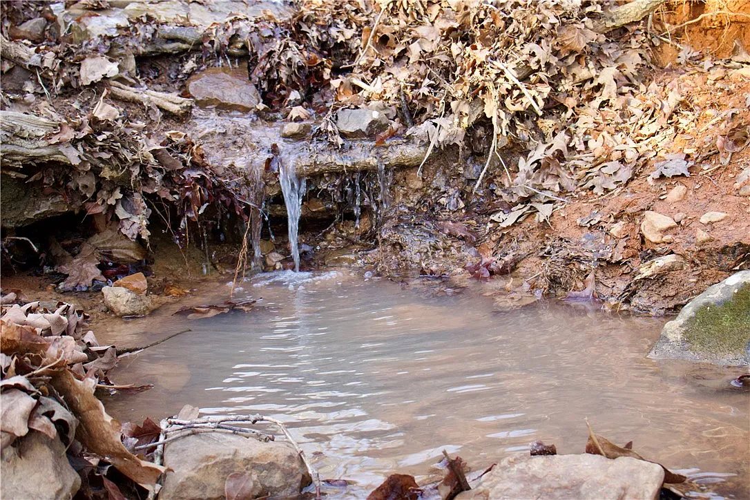
Everything checked, who says so, and every line where the honest answer is that nobody has looked yet.
| Item | What we found | Status |
|---|---|---|
| Boundary | Surveyed by Satterfield Land Surveyors P.A., job 50,311, dated March 23, 2026. Tract 2 of a two-tract split of the NW 1/4 SW 1/4, Section 1, T-12-N, R-30-W. Crawford County parcel 001-17902-000, 22.37 acres, recorded to Off Grid Acres LLC by deed doc #2026001252, filed February 9, 2026. Rebuilt from the plat's metes and bounds as a check: closes to 0.01 ft and computes 22.3718 acres against 22.37 stated. Read the survey (PDF). | Surveyed |
| Access | Price Road forms the north and north-west boundary along its centreline for 1,992 ft, so the tract fronts the road directly and is not landlocked. The parent forty was split along that centreline, which is how a road right of way over the abutting owners' land is normally described. Grade profile published above: 6.9% average, three pitches at 10% or steeper, maximum 16.1%. | Direct |
| Road maintenance | Not county maintained. Crawford County Road Department, September 8, 2026: neither Price Road nor Carter Lane Road is on the county maintenance list, and the property owners are responsible for keeping them up. The county declined to characterise Price Road as a private road, saying only that it is privately maintained. About 2.6 miles of the approach from US 71 is unpaved and owner maintained. Detail above. | Owner kept |
| Maintenance agreement | None found. No recorded road maintenance agreement surfaced in the title work when the current owner acquired the parent tract, and none has turned up since. We are not asserting one does not exist, only that we have not seen it. It is the document a lender is most likely to ask for on a road like this, and it is what would set each owner's share of a grading bill. | None found |
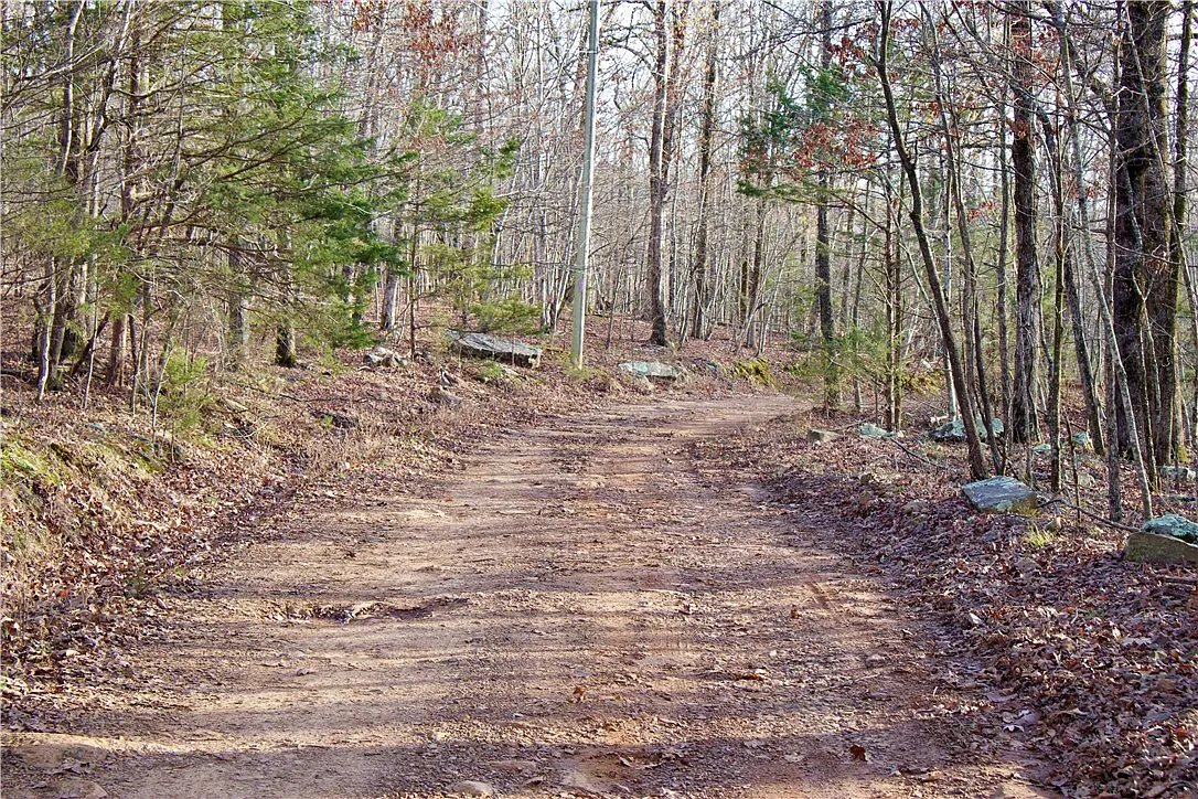
| Electric | On site, and OG&E confirms it serves here. The overhead line runs the length of the road frontage under the recorded 1989 easement. The surveyor located the poles on the ground in March 2026 and labelled the line as overhead electric, and the last pole stands 25.94 feet short of the south line beside the gravel drive. One of those poles is in the road photograph on this page. OG&E New Construction confirmed the service territory on September 16, 2026, checked against a neighbouring address on Price Road. What decides the cost of a hookup is the distance to the nearest transformer, and that has not been established. Their rule is that a residential service within 300 feet of a transformer is typically no cost. Past 300 feet nobody will quote it over the phone; it takes a project initiation form and a site visit. They could not locate the transformer for us because this tract has no 911 address. What can be measured is the distance to the line itself, and the bench is closer to it than the acreage suggests: 4.5 of its 9.7 acres sit within 300 feet of Price Road, it touches the road at its nearest point, and its far end is 810 feet back. Whether a transformer would be set on a pole near the build site, which is what would make that the right measurement, is one of the things the project form settles. We are getting the nearest transformer located and the distance will be published here. | On site |
| Topography | 1,461 to 1,633 ft, 173 ft of relief. 62% of the tract under 15% grade, the largest connected piece being 9.7 acres at 1,530 to 1,589 ft, plus a separate 1.2-acre shelf at 1,603 to 1,620 ft. Measured off USGS 3DEP 10-metre elevation inside the surveyed boundary. | Measured |
| Soils | Measured on this tract rather than on the parent forty, and it matters. USDA maps about 92% of this tract as Enders-Mountainburg association, 8 to 20 percent slopes, and only 8% as the steeper Nella-Enders complex, 20 to 40 percent, in one patch at the far south-west corner. The forty as a whole runs 76 / 24, and the reason this tract reads better is that almost all of the steep ground lies on the other side of Price Road: the 17.29 acres north-west of the road are 44% Nella-Enders. Inside that dominant unit the named components are Enders at 60% and Mountainburg at 30%, and the difference between them is the whole septic question. USDA puts bedrock under Enders at 40 to 60 inches, representative 54, which is well below any trench. Under Mountainburg it is 12 to 20 inches, which is not. NRCS rates the map unit Very limited, but that is a rating for a whole unit at its worst, and its own scoring shows what drives it: for Enders the binding constraints are slope and slow percolation, with depth to bedrock scored roughly half as limiting. None of it gates permission, because this tract is permit exempt, see the Septic line below. What the soil decides here is where a field goes and how big it needs to be, not whether one is allowed. | Better than rated |
| Septic | No permit, and no perc test. This tract is over ten acres, so it is exempt. Arkansas exempts a single residence on ten or more acres where all parts of the sewage system sit more than 200 feet from every property line, including roads. Kurt Dieter, the Arkansas Department of Health on-site wastewater specialist for this county, confirmed it by phone on September 17, 2026, and confirmed it applies regardless of soil or bedrock, because it is an exemption from permitting rather than a finding about the ground. We measured whether this tract can actually meet the setback rather than assuming it: 5.84 acres sit more than 200 feet inside every line, and 4.69 of those acres fall on the 9.7-acre bench. The qualifying ground and the good ground are the same ground. The limits, stated plainly: the exemption covers the permit only, the system still has to be installed to state standards and not become a nuisance, it is for one residence, and it displaces no other state or federal requirement. On a well you need nothing further. On public water a utility sometimes asks for a letter, and the local Health Unit issues one. ADH also puts a well 100 feet from the field. Anything unusual in your layout is worth a call to Kurt before you dig. | Permit exempt |
| Water: a well | Measured, not drilled. Sixty eight state well construction reports for this township were read off the filed forms, three of them in this section. Expect 200 to 220 ft, water standing about 30 ft down, and 0.25 to 0.58 gallons a minute, which needs a storage tank and a low yield pump rather than a deeper hole. Two holes is a real outcome here: there is a dry hole about two miles off and a second attempt in this section. Nothing has been drilled on this tract and no driller has quoted it. The full record is on this page. | 68 logs read |
| Water: public supply | None mapped here. This tract falls outside every mapped public water service area in Arkansas, sitting in the gap between Washington Water Authority three quarters of a mile north and Winslow Waterworks about as far to the south east. A service area boundary is a franchise territory rather than a pipe, and the telling fact is that ground in this section was drilled in 1995 and again in 2001 rather than connected. Assume a well. Neither district has been rung to have it said out loud: Washington Water Authority 479-267-2111, Winslow Waterworks 479-634-3901. | None mapped |
| Zoning | There is none, and there are no county building permits either. Crawford County Assessor’s office, real estate division, September 16, 2026: “there is no zoning at the county level. There’s no building permits at the county level. So if you’re outside the city limits, anything goes.” This tract is outside any municipality, and the county’s own list of offices carries no planning, zoning or code enforcement department, which fits. That is the county’s summary and not a legal opinion, and it is not the same as no rules at all: a septic system still needs a state permit, see the Septic line above; the 1989 utility easement still bars building inside its strip; and any restriction of record runs with the land. The same office was clear that it has no jurisdiction over the question itself and named the county judge’s office, 479-474-1511, as the responsible party. That is where to get it in writing if your lender or your builder wants it from the county rather than from us. | No zoning |
| Easement: access | A 1985 easement deed grants the south adjoining owner the right of ingress and egress only, over a roadway approximately twelve feet wide at the south-west corner of the forty, connecting that owner's property to the road through it. Recorded at Book Misc 53, Page 181. It is not drawn on the survey, at the client's instruction, but it is of record Detail above. | Of record |
| Easement: utility | A 1989 easement to Oklahoma Gas & Electric, ten feet wide, five feet either side of the overhead line, running from the north-east corner of the forty south-westerly along the existing road to a point on the south line about 149 ft east of the south-west corner. No building and no change of grade inside it without written consent. Book 89-17, Page 484. This is the line that puts electric on the tract. Detail above. | Of record |
| Flood & wetlands | None mapped. Zero percent of the parent forty falls in a mapped FEMA flood zone and zero percent maps as wetland on the National Wetlands Inventory. The water feature in the photographs is not a mapped stream; its seasonal behaviour has not been observed by us. | None mapped |
| Taxes | The 2025 bill of $52.63 was assessed against the undivided 40 acres, before the split. Treat it as history rather than as this tract's bill; a reassessment on 22.37 acres has not run yet. | Parent only |
| Schools & address | Mountainburg School District. The mailing address reads Winslow 72959, which is a Washington County post office, but the land is in Crawford County. That catches people out and it changes which courthouse, which assessor and which school district you are dealing with. | Confirmed |
| Owner financing | Available on a financed purchase price of $149,000 with 30% down, which is $44,700. That is a different number from the $125,200 cash price, and the difference is what the financing costs. There is no bank application and no income verification, though a credit check is run. Terms need a credit score above 650. The full terms are written out here, and Chris on 479-530-2470 can walk you through them. Rate and term are subject to a written agreement. | Available |
* The tax figure is the parent forty's, pre-split. See the Taxes line above.
Because the alternative is a listing that says "multiple build site options" and leaves the buyer to drive out and find out. Every tract has a hard question. On this one it is the road and the water, so those get the most words rather than the fewest.
The lines above that say nobody has checked yet are the honest state of the file today, not an oversight. As the road answer, the driller quotes and any soil work come in, they land on this page whichever way they go.
Go and see it
The tract is listed by Chris Shadrick of Midwest Land Group, and every showing, question and written offer goes through him. We sourced it, we commissioned the survey and the terrain work on this page is ours, so whatever you want to know about the land, he can get you the answer that came from the work.
Price Road forms the boundary, so you can drive the frontage whenever you like. Open the tract in Google Maps before you set off: the approach is about 2.6 unpaved miles in from US 71, and Price Road dead ends past the tract. There is no house number at the road, so navigate to the pin rather than to an address. The survey is right here. If you want the county road department’s answer or the well records before you make the drive, ask Chris and we will get them to him for you.
Call or text Chris on 479-530-2470
Chris Shadrick · Midwest Land Group, LLC · 479-530-2470
ArkansasOne MLS 1335884 · Crawford County parcel 001-17902-000 · page prepared by Noble Land Partners®, joint venture partner on the tract
The tract on Google Maps · 35.74069, -94.14047
35 closings across 24 counties in five states. Noble Land Partners® is BBB accredited with an A+ rating, 18 customer reviews averaging 5 stars, and no complaints closed in the last three years.
 Noble Land Partners